


13-Voting District (East Side of City of Labelle), Hendry County, Florida
About
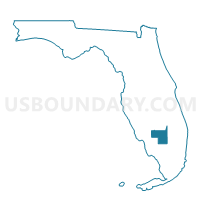
Outline
%2c+Hendry+County%2c+Florida_A280.png)
Summary
| Unique Area Identifier | 553459 |
| Name | 13-Voting District (East Side of City of Labelle) |
| County | Hendry County |
| State | Florida |
| Area (square miles) | 1.89 |
| Land Area (square miles) | 1.89 |
| Water Area (square miles) | 0.00 |
| % of Land Area | 100.00 |
| % of Water Area | 0.00 |
| Latitude of the Internal Point | 26.75168330 |
| Longtitude of the Internal Point | -81.42676840 |
Maps
 in Hendry County.png)

Graphs
Select a template below for downloading or customizing gragh for 13-Voting District (East Side of City of Labelle), Hendry County, Florida
%2c+Hendry+County%2c+Florida_T0.png)
%2c+Hendry+County%2c+Florida_T1.png)
%2c+Hendry+County%2c+Florida_T2.png)
%2c+Hendry+County%2c+Florida_T3.png)
%2c+Hendry+County%2c+Florida_T4.png)
%2c+Hendry+County%2c+Florida_T5.png)
%2c+Hendry+County%2c+Florida_T6.png)
%2c+Hendry+County%2c+Florida_T7.png)
%2c+Hendry+County%2c+Florida.png)
Neighbors
Neighoring Voting District (by Name) Neighboring Voting District on the Map
- 12-Voting District (West Side of Port Labelle), Hendry County, FL
- 14-Voting District (West Side of City of Labelle), Hendry County, FL
- 22-Voting District (Monkey Town Area), Hendry County, FL
- 26-Voting District (North City of Labelle), Hendry County, FL